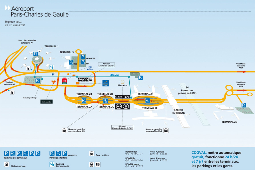
Plan aéroport Roissy CDG Français

Roissy airport map

Roissy Charles de Gaulle is the main airport serving Paris: It is located 25 km North of city center. Leaving the airport by car? The A1 & A3 motorways connect directly Roissy airport to Paris city center (Porte de La Chapelle or Porte de Bagnolet exits). Consider the roads map at the bottom of the page. Please also find here below the official Roissy airport map showing parking facilities, concourse maps, and on site hotels...

Roissy airport shuttle service

Compare top airport transfer providers in Paris.
Read customers reviews and book your Roissy airport transfer. Compare now: Roissy airport shuttle

Roissy airport shuttle service

Download Roissy airport terminals map (PDF)

Download the official Roissy airport map: Click on the link below or refer to Paris airport official website to get details about services in each terminal: Roissy terminals maps
(Map courtesy of ADP)

Download the map (Jpg)

Plan your route before coming to Paris. To download Roissy airport map please refer to official website.
See: Download Paris Roissy airport map

Map - Road directions: Where is Roissy airport located?

Other airports: Orly airport map - Beauvais airport map

Compare airport shuttle providers
Adults
Child
Age
Shuttle-paris.com